
Walk a Redmond Street by Address
A Redmond street is not a single record unit. Treat it as a series of confirmed parcels. Keep the street number, NE, NW, SE, or SW direction, street name, type, any suffix direction, and the date the source was checked. Directions matter in Redmond's cardinal grid. Dropping one can point to another street or an unrelated county result. Validate the postal form first, then use county property information for parcel identity and the City map for municipal context. A postal Redmond address can fall outside the City limits, so a county parcel view and a City layer answer different questions.
For a current address search, begin with the physical situs, not an owner name. That order reduces collisions with similarly named roads, mailing addresses, and entity-held parcels. Save the account number and map/tax-lot as soon as the correct result is open. Those identifiers make a later title or historic-index search repeatable.
- Confirm the number, direction, street name, and postal form, then search DIAL by Property Address (Situs) with a useful full or partial address.
- Check the displayed situs, City filter when it appears, account number, and map/tax-lot before accepting a parcel match.
- Open the interactive map to inspect parcel boundaries, street connections, and the relevant map layers without treating map proximity as proof about people.
- Use a DIAL sale or document lead to locate the Recorder entry, then compare its recording number and legal description with the parcel.
- For a dated historical association, pair a tax-roll or title event with a directory or census record from the same period. Use the controlled voter-request route only for the precise civic record product needed.
Each stop answers a narrower question. A parcel account identifies an assessment record. A deed names parties in an instrument. A dated directory prints an address association. The record date and label belong with every note.
Redmond Street Directory Search Fields
Deschutes County DIAL's situs-address search is the practical first stop for address research. Standard access is free and requires no registration. Its help material favors a partial entry when an exact-looking form produces no result. Search a distinctive number and street fragment, inspect the candidates, and narrow with the dynamic City filter only after results load. The filter is data-driven, so it may not appear for every search.
| DIAL control | How it works for a Redmond address |
|---|---|
| Search type | Select Property Address (Situs). |
| Value | Enter a full or partial address, using a stable number and street-name fragment. |
| Fast Filters | Use the City option to narrow to Redmond when the result set supplies that filter. |
| Account number | Save it after opening the confirmed record for repeat searches. |
| Map/Tax Lot | Save it for map work, Recorder research, and historic-index continuity. |
| Reports | Basic, Full, and Custom reports document the public view accessed. |
The DIAL situs screen shows the address-first route used for Redmond street research.
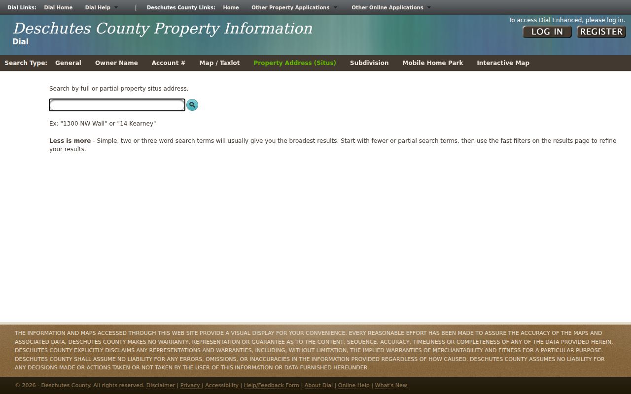
A returned account should be checked against the displayed situs and map/tax-lot before any sales, documents, or map links are followed.
Note: The owner or mailing panel is an assessment label and can differ from the physical situs address.
Read Redmond Streets on DIAL Maps
Use the DIAL Interactive Map after the parcel is confirmed. It supports street, aerial, and topographic basemaps, layers, measurements, and a right-click route from a parcel to its account. Those tools are useful for deciding whether two frontage segments belong to the same parcel pattern or whether a street connection changes at a boundary. They do not create a roster of people on the road.
Enhanced DIAL access is also free, but it requires an email and password. It adds Recorder-document links, mailing-label tools, and Street View. The enhanced mailing-label feature is a spatial mailing tool. Its output should be read as the system's parcel or mailing context, not as a statement of who occupies a location.
DIAL's search help documents the available search paths, reports, map use, and the distinction between Standard and Enhanced access.
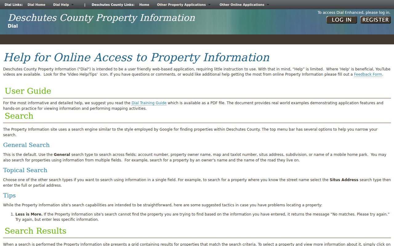
Map selection works best when it follows a confirmed situs search, because the account link supplies a durable county identifier for the research log.
Redmond Street Directions and Boundaries
Redmond's 1905 townsite and its 1910 incorporation help explain the modern directional grid. Historic records may instead identify a block, lot, plat, or metes-and-bounds description. That is why NE, NW, SE, and SW components should be retained in street-directory notes even when a search is broadened. A current-looking address may not appear at all in an early deed, and a matching street word is not enough to join two locations.
The City of Redmond maps and property-information page supplies municipal context. DIAL covers parcels countywide. Compare both sources near the City edge, an annexation area, or a planning boundary. A City map is not a survey, and a Redmond mailing name is not by itself a City-jurisdiction finding.
This geography matters for records requests. City permit or planning material belongs with the City when the location falls in the applicable municipal context. County assessment, recorded-title, and historic-index work remains tied to Deschutes County systems.
Redmond Street Permit Searches
Building and planning records can add dated work-site context to a Redmond address search. They are not a current household list. Oregon ePermitting uses a different input convention from DIAL. For the described address search, enter the number and the first three characters of the street name, leave Direction and Post Direction blank, and try a numbered street in word form when needed. That portal rule does not erase the directional component needed for DIAL or postal research.
| ePermitting route | Instruction for the address search |
|---|---|
| Work Site Location / Street Number | Use the exact number for the best address search. |
| Street Name | Enter the first three characters; spell out a numbered street if necessary. |
| Direction and Post Direction | Leave both blank for the described search. |
| City fallback | If needed, use a percent sign in Street Name with the city. |
| Permit/Application Number | Use as an alternate route; older records may require clearing Start Date. |
Oregon ePermitting's address-search instructions show the portal-specific field rules.
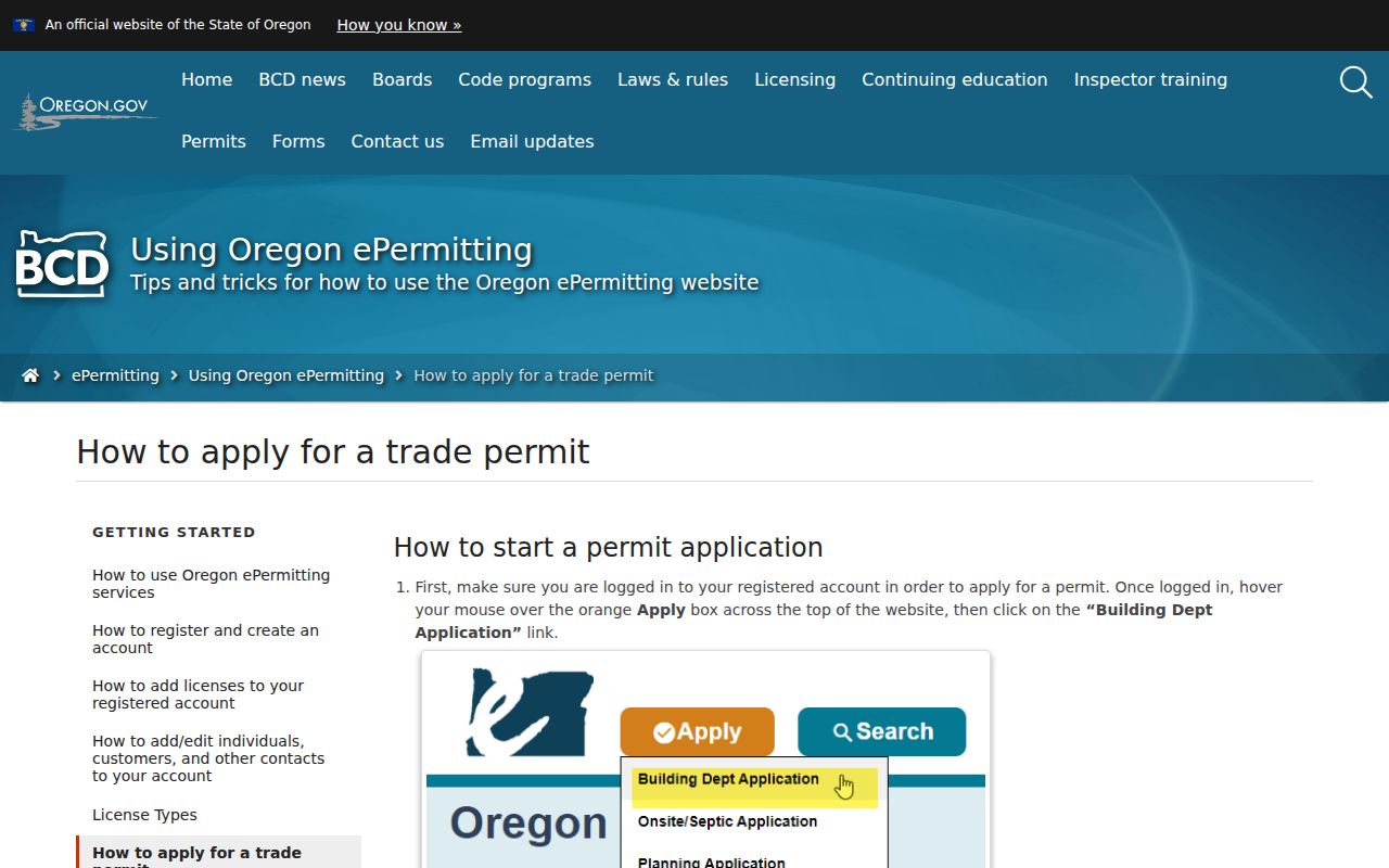
If a permit screen has no match, the result can reflect a new address, a different jurisdiction, or narrow terms. Confirm the parcel and ask the responsible City or County department about a lawful records route.
Redmond Street Records by Address
A Redmond address record is strongest when it keeps source labels separate. The Assessor's DIAL account establishes parcel and tax-record context. The Recorder establishes what an instrument indexes. The permit system can show a work-site record. City maps identify municipal context, while county mapping identifies the parcel. The table distinguishes those tasks so that an address connection is not inflated into a claim about present residence.
| Address-keyed source | Custodian | Useful public label | How to reach it |
|---|---|---|---|
| DIAL parcel account | Deschutes County Assessor | Account, map/tax-lot, situs, tax and sales context | Free Standard portal; map and reports are available |
| Interactive parcel map | Deschutes County | Parcel boundaries, layers, measurements, account route | Public map; Enhanced features require free registration |
| Recorded instruments | Deschutes County Clerk, Recording | Recording number, parties, document date/type, legal description | Online official records and Clerk copy route |
| Historic deed indexes | County Records Research and public research area | Direct/indirect index, book/page, plats, and related historic series | County guide, historical indexes, and archival research |
| Permit or planning record | City of Redmond / applicable jurisdiction | Work-site, application, or project context | ePermitting, City resources, or a focused written request |
The Deschutes County Assessor's Office describes the assessment role and directs property researchers to DIAL for account, tax, valuation, and sales information.
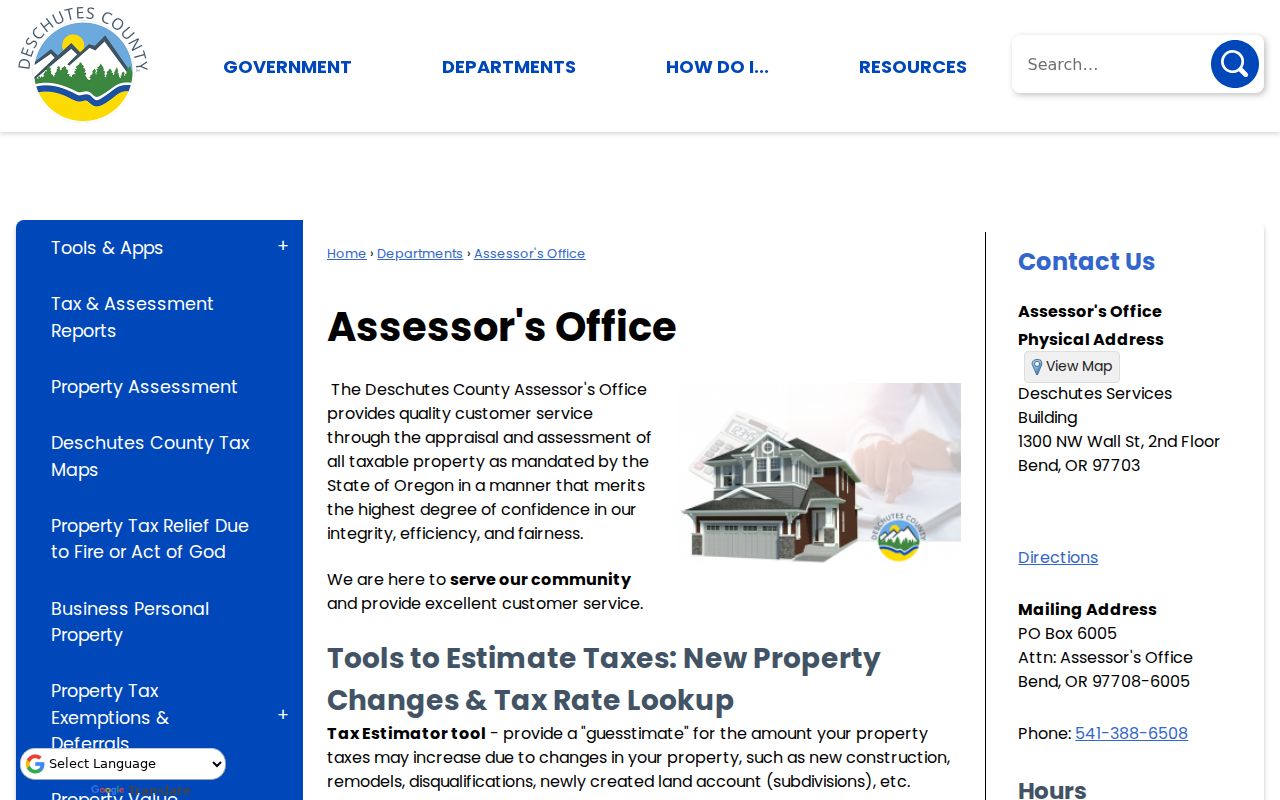
Capture the account and map/tax-lot first, then use the sale or document references as leads rather than treating an assessment display as title proof.
Recorder Trails Along Redmond Streets
The Deschutes County Clerk's Recording service is the title-record custodian. Official Records are online from 1983 forward. The County's historical research route includes direct and indirect deed indexes for 1871 through 1984, which overlaps the modern online boundary. Use both paths when the transaction falls near that overlap rather than assuming a clean digital divide.
Open a DIAL sales lead or document link, retain the recording number, then compare the document type, direct or indirect party role, recording date, and legal description with the parcel. The Recorder's party labels describe indexing roles. They do not establish a household relationship or actual presence at the situs. Online images are non-certified. When certification matters, request a certified copy from the Clerk using the exact record reference.
Historical work may require the County's public research area or the State Archives inventory rather than a modern screen. The historic menu also identifies mortgage, miscellaneous, patent, subdivision-plat, and metes-and-bounds indexes. Those routes are especially useful when a street name is absent from an older instrument.
Older Redmond Street Labels and Plats
Before a modern street form is carried backward, inspect the legal description. Subdivision plat indexes and metes-and-bounds grantor/grantee indexes cover material before 1960, and patent indexes cover 1905 through 1917. A parcel may also have been split, replatted, or folded into later development. Preserve a break in the chain when the descriptions do not line up. A careful address record can show the research path without pretending every old label identifies the same ground.
- Parcel
- A mapped unit in the county assessment system, identified by an account number and map/tax-lot.
- Situs address
- The physical property address displayed for the assessment record, distinct from a mailing label.
- Plat
- A recorded map that lays out lots, blocks, streets, or a subdivision and can bridge old legal descriptions.
- Criss-cross directory
- An address-arranged directory. No reviewed official source confirms a complete Redmond criss-cross run.
For historical printed listings, the verified Central Oregon directory holdings are described as about 1940 through 1990, plus scattered teens and twenties volumes. The collection is not confirmed as annual or fully address-arranged. Dated volumes and census schedules belong in the address-history process, with their own citations.
Redmond Street Civic Records Need Scope
Oregon My Vote is for a voter to check that voter's own registration and ballot functions. It is not an open name-and-address roster. For public-record research, Deschutes County provides a Voter Information Request Form and Oregon provides a voter-list request route. The County form uses requested product, county or district geography, precinct, party option, election selection, format, applicant contact details, signature, and date. A Voter Walking List is the closest named product for street-oriented civic work.
That does not make it a definitive household list. The form does not promise a citywide street-address parameter for every product, and voter records have protected elements and address-confidentiality rules. First confirm jurisdiction and precinct through official maps or elections staff. Then request the smallest supported geography and follow the form's conditions. Do not merge a voter result with a parcel or deed record unless date and identity evidence support the connection.
Note: A controlled voter-file request is a records process, not an open Redmond resident roster.
Limits of Redmond Address Records
Street records can document parcel, title, permit, mailing, or dated-directory labels only as those sources display them. They cannot establish who currently occupies a site, every person connected to an address, community membership, or a relationship between people. A tax mailing label is not occupancy evidence. A permit applicant or recorded party is not automatically a resident. Protected addresses, redactions, and limits on court or vital records remain protected.
Use the facts for family history, estate research, property history, civic context, or a carefully bounded personal question. For a record that is not public online, ask the correct custodian about a narrowly described request, a redacted version, cost estimate, and expected response rather than trying to bypass access controls.
Lawful use. Use Redmond address records for lawful personal research and respect confidentiality protections. Oregon law prohibits stalking and harassment, so never use a record to target, threaten, or repeatedly contact someone.